History and heritage

On this page:
Becoming Redland City

Becoming Redland City - Local Government
When Moreton Bay was opened to settlement from 1842, free settlers began to move to the Redlands Coast. At first all the land from Ormiston south through Mount Cotton and Redland Bay to the Logan River was leased to grazier Joseph Clark, who ran cattle on the land. The first land sales in the region were held in 1851, and Clark soon relinquished the lease. New land owners had to clear their land, so timber and saw-milling was a major early industry. Crops gradually replaced grazing. And for the next 100 years, most people who lived in the Redlands Coast region were farmers or fishermen on the mainland and Islands.
In 1885 the Cleveland Divisional Board, later renamed Cleveland Shire Council, was formed, and soon built its new office on a site that was by then surrounded by farmland, which had curtailed the traditional Quandamooka ways of life in the area. For countless years the site had been a hub for corroborees, trading and celebrations on the shores of Raby Bay (Doobawah) with hundreds of people meeting there. This old Shire Hall building was still in use in 1949 when Cleveland Shire Council merged with parts of Tingalpa Shire Council to form the Redland Shire Council. A wing was added at that time, then in 1969 it was replaced by a new brick building. In 2008 the Shire was granted City status, and today its extended building is still an important meeting place, continuing the age-old use of the land upon which it sits.
Our crest and logo

The Council Crest
The Council Crest was commissioned in 1976, when then Shire Chairman EG Wood wrote to the Duke of Norfolk. He in turn ordered its preparation by the representatives of the Garter, Clarenceaux and Norroy and Ulster Kings of Arms, who sealed the design as belonging exclusively to Redland Shire Council (sic) on July 8, 1977.
Each section of the crest has a meaning:
- the tree at the top - represents the Poinciana trees which grow in the area
- the ship - represents Matthew Flinders' Sloop, the 'Norfolk', in which he explored the southern part of Moreton Bay in 1799
- the lighthouse - is the old Cleveland Lighthouse, which was a landmark and a working light until it was replaced in February, 1976. Redland City Council has preserved this lighthouse at Cleveland Point. The old light from the top is now housed at the Council Chambers. The lens was made in England by Chance Brothers and Company, near Birmingham, England, in 1875
- the island in the background - represents North Stradbroke Island
- Gladiolus spikes in the lower portion - represent the Shire's strong horticultural base and the cornucopia is discharging a colourful array of fruit and vegetables which have been traditionally grown in the Redlands
- Latin inscription at the foot of the crest - means 'Crescat' May it Grow - 'Floreat' May it Flourish.
Redland City Council logo
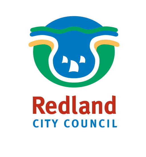
This council logo was adopted in 1995 as part of Vision 2005, a community consultation process which developed a blueprint for the future growth of the Redlands.
The logo showcases the aspects of our area that Redlanders say they treasure most:
- clean air
- islands
- foreshore
- bushland
- sailboats to celebrate the bayside lifestyle.
The Redlands' rich wildlife is depicted by the koala - cleverly formed from the other design elements.
Corporate colours
The logo colours have great meaning to the local community:
- red for the red soil and Poinciana blossoms.
- green for our abundant bushland
- blue for beautiful Moreton Bay
- yellow for our extensive foreshores.
Our visual identity presents a progressive and forward-looking organisation through the use of striking colours and clean, contemporary lines.
Heritage trails
Take a walk or drive along our local heritage trails to discover our city's rich historic locations.
Cleveland and Ormiston heritage trail
Take a walk or drive through Cleveland and Ormiston and visit over 35 historic locations, including:
- Ormiston House
- Black Swamp Wetlands
- Cleveland Cemetery
- Redland Museum
- Cleveland Rifle Range
- Grand View Hotel
- Norfolk Island Pines
- Fig trees
- Court House Restaurant
- Cleveland Point
- and more.
Map of the Cleveland and Ormiston heritage trail(JPG, 882KB)
Please note: In July 2017 the Station Master's House was relocated from 204 Middle Street to Linear Park at 120 Shore Street North (beside the Redland City Lions Hall and Old Schoolhouse Gallery).
North Stradbroke Island heritage trail
The North Stradbroke Island heritage trail covers 30 historic locations within the island suburbs of Dunwich, Amity Point and Point Lookout.
Along the trail you'll discover sites including:
- Convict causeway
- Anzac Park
- North Stradbroke Island Historical Museum
- Benevolent Asylum cottages
- Polka Point Midden and draughts board
- Dunwich Cemetery
- Former Aboriginal Mission (Terra Bulla Leumeah Conservation area)
- Myora Springs (Capembah)
- Cook's seat
- Point Lookout Lighthouse
- and more.
Map of the North Stradbroke Island heritage trail(PDF, 3MB)
Coochiemudlo Island heritage trail
Visit the 11 locations along the Coochiemudlo Island heritage trail to take in:
- Island transport
- Pioneer Park
- Scar trees
- Norfolk Beach
- Melaleuca wetlands
- Morwong Beach
- Track and observation lookout
- Morton's steps and jetty
- Flinders Lookout
- Coochimudlo Island Community Hall
- Golf Course.
Lamb Island heritage trail
The Lamb Island heritage trail covers the following historic locations:
- Lamb Island jetty shed
- Thomas Lucas grave
- Mango trees and farmhouse
- Lamb Island Pioneer Hall
- Harry Brook Reserve, house and farm buildings.
Macleay Island heritage trail
The Macleay Island heritage trail covers 11 historic locations, including:
- Ron Field Marine Facility
- Progress Hall
- Campbell's saltworks
- Arboretum
- Perrebinpa Point
- Tim Shea's waterhole
- Thompson's Point
- Pat's Park
- Cow Bay
- Lovell's house
- Corroboree Place and Lions Park.
Russell Island heritage trail
The Russell Island heritage trail covers 12 historic locations, including:
- Russell Island jetty
- St Peter's Parish Hall
- Jock Kennedy Park
- Farm
- Russell Island State School
- Laurel Street
- Bowls club, fire station, Hans Shcultz Green
- Jackson ville
- RSL
- Canaipa Point
- Mrs Fischer's grave
- Rocky Point
- Lions Park.
Related links
- Local heritage places - Information on local heritage places and Council’s local heritage register.
- Redlands Coast history - Find online images, stories and timelines that will help you to discover the rich and sometimes surprising history of the Redlands Coast.
- Our Quandamooka Origins - About our region's rich Indigenous heritage
- Place names - Our towns and suburbs, our islands, creeks, parks, streets and homes all have a story to tell.